HISTORY TOUR
Tauranga in the 21st century looks peaceful and prosperous. But in the 1860s it was at the centre of conflict, with fierce fighting between Imperial troops and militia on one side, and Māori warriors on the other.
Two of the most significant Battles of the New Zealand wars were fought on this soil, at Gate Pa and Te Ranga.
Their aftermath – land confiscation and dispossession – still resonates today. Take this tour to see where it all really happened...
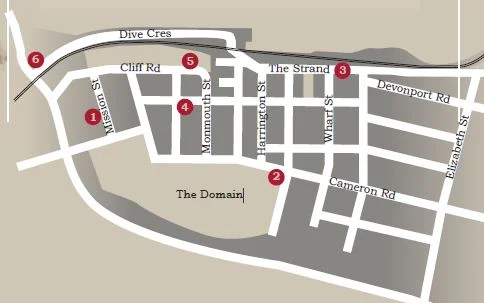
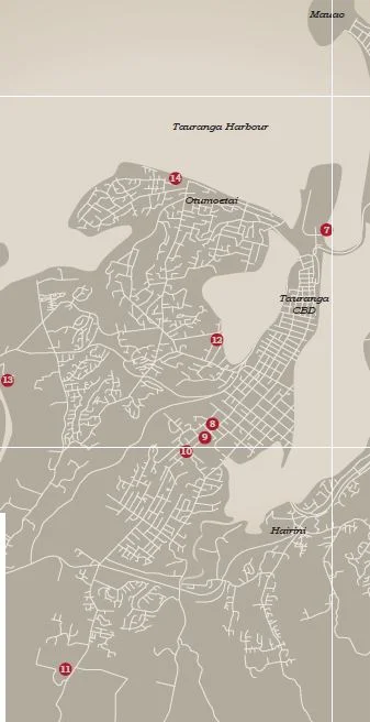
GUIDED TOUR MAP

Painting of Hēnare Wiremu Taratoa 1864 by Robley of
Ngaiterangi Rangatira. Taratoa drafted the Order of conduct for the Battle of Pukahinahina (Gate Pā) and Te Ranga.
1. The Elms / Te Papā Mission Station
On 28 April, 1864, the eve of the Battle of Gate Pa, all the officers not on duty dined with Archdeacon Alfred Brown and his wife, Christina, around the oval table still in the dining room of the mission house. After the meal Brown administered Holy Communion, then everyone joined in singing the hymn Abide with me, accompanied by Mrs Brown on the small piano.
The next day all their guests were killed, except for Dr William Manley, who received a VC for his
bravery during the Battle.
2. Durham Redoubt
Built on high land by the 68th Durham Light Infantry to guard against invasion from the west, the Durham Redoubt was flattened in the 1870s to raise the level of Hamilton Street. The southern part of the Tauranga Domain was used as a parade ground by the 68th.
3. Camp Te Papa
The peninsula on which the town of Tauranga was established was originally known as Te Papa, and so the military camp was referred to as Camp Te Papa. The area stretching from Beach Road, (now The Strand) below the Monmouth Redoubt west as far as Cameron Road, and from Brown Street to about Hamilton Street is still known as The Camp by older residents. Barracks and tents for the troops were set up in this area.
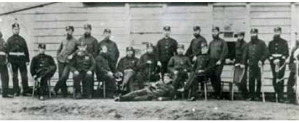
Durham Light Infantry c.1864
4. Surrender of arms
The main surrender of arms took place on 26 July 1864 on the lawn outside the house occupied by Colonel Greer, at the intersection of what is now Willow and McLean Streets. The house had been built for Rev George Clarke in 1861. In the presence of military officers, missionaries and government officials 156 Māori warriors handed over muskets, rifles, taiaha and mere
5. Monmouth Redoubt (Taumatakahawai Pā)
Early in 1864 troops were sent from Auckland to the Tauranga district to stop the flow of warriors and supplies going into the Waikato in support of the Kingite Māori. Soldiers of the 43rd Monmouth Light Infantry refortified an old pā site, Taumatakahawai, which looked eastward over the Waimapu harbour. This redoubt was later a place of refuge for women and children when attacks by Māori were feared in the mid1860s.

6. Mission Cemetery (Otamataha Pa)
All the soldiers and sailors who died at the Battles of Gate Pā and Te Ranga were buried in the cemetery established by the missionaries in 1838. It is also the resting place of many Māori warriors who fell in Battle or died in the military hospital. For many years the cemetery was referred to as the Military Cemetery.
There are monuments to the Naval Brigade, the 43rd Monmouth Regiment, and a mass Māori
grave. Rāwiri Puhirake, leader of the iwi at Gate Pā, who was killed at Te Ranga, was exhumed
and reinterred here in 1874. Hōri Ngātai, whose account of Gate Pā appears in Mair’s ‘The Story of Gate Pā’, was buried here when he died in 1912.
7. Port of Tauranga
A blockade of the port of Tauranga was imposed on 2 April 1864, to stop reinforcements and supplies going to the Kingite Māori in the Waikato.
8. Pukereia (Green Hill)
The Royal Artillery and the Naval Brigade set up
heavy artillery in four separate positions to the north of the Gate Pā. The range varied from 800 to 350 yards. From these positions a bombardment of the fortifications was kept up until late afternoon on 29 April. General Duncan Cameron had his base at the Headquarters camp, close to the artillery position.
9. Gate Pā Battle Site Upper and lower pā sites
The main fortifications, designed and built by Pene Taka Tuaia, were located on high land to the east of the track to the Kaimai ranges, which is now known as Cameron Road. The pā was just outside the gate in the fence which enclosed land purchased by the Church Missionary Society in 1839. It was therefore known as “The Gate Pā”. The hill was called Pukehinahina, and this name is also used to refer to the Battle. The Battle site is now a historic reserve with interpretation panels and tomokanga.
The 68th regiment converted the pā into a redoubt even before the Battle of Te Ranga in1864. The remains of the trenches were filled in by Greerton residents in 1877, obliterating all signs of the pā. Another smaller pā was built to the west of the track. It is now a recreation reserve, with bowling greens and tennis courts.
10. St George’s Church
The first St George’s church was built in 1900 as a memorial to the Battle. The church was extensively
damaged by fire in 1982, and virtually destroyed by fire in 1992. The present church dates from 1993.
There is a stained glass window commemorating water being given to the dying Colonel Booth by Heni
Te Kirikaramu (Jane Foley). Three tukutuku panels also relate to the Battle.
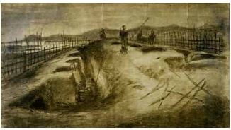
Earthworks and fence of the Gate Pā looking from the beach. 30 April 1864.
11. Te Ranga Battle Site
A sign beside the road to Rotorua, about four kilometres from the Barkes Corner roundabout, marks the entrance to the Battle site. In June 1864 soldiers on patrol encountered several hundred Māori fortifying a position south of Gate Pā Pukehinahina. Reinforcements were called for, and an engagement took place at Te Ranga. Although Māori fought bravely the result was a victory for the
British troops. The Māori defeat at Te Ranga led to the confiscation of land in the western Bay of Plenty.
12. Judea Redoubt
In anticipation of an attack by Māori, British troops built several redoubts, including one known as the
Judea or India Redoubt.
13. Poteriwhi Pā
At this pā on the lower Wairoa River Hēnare Taratoa and other chiefs drew up the Code of Conduct, in
which Māori promised to treat their enemies well. The Christian ideals embodied in the document, and the honourable way in which Māori behaved to the fallen soldiers are part of the legend of Gate Pā Pukehinahina.
After the Battle of Gate Pā on 29 April 1864 Māori retreated to Poteriwhi, although imperial troops found it deserted several days later. The palisades were dismantled and burnt, and the original pā modified into a redoubt.
14. Otumoetai Pā
Before the land wars of 1864 this pā was densely populated. Otumoetai Pā was an economic, political
and religious centre between 1836 and 1865. As it was situated in the land confiscated by the government, the people who lived there were forced to leave their ancestral home.

“Awaiting the order to advance” (for the battle of Gate Pa). Taken at sunrise on 29 April 1864. General Duncan Cameron is leaning on the wheel of the gun carriage, (fifth from right).